Showing posts with label mountain. Show all posts

Sunday, September 28, 2025

The Wild Side of Japan


Beyond the neon skylines, crowded subways, and hi-tech innovations lies another Japan – a wilder world of mountains, forests, and rice paddies that reveal the country’s deep relationship with nature.


The hills are shaped like traffic cones, except that they’re green. Many of them reach up to over 1,000 meters; the tallest ones nearly 3,000 meters. They stand on both sides of the road – Akita Expressway – blocking any view beyond them except for the sky, which that day was overcast. The forested slopes look virtually impenetrable. There are signs warning of mountain goats, tanuki-raccoon dogs – and bears – along the roadside.

Tohoku, consisting of the northern prefectures on the main island of Honshu, has been called the wild side of Japan. If Japan conjures up images of avant-garde high-rises, hi-tech attractions, and people in dark suits or outrageous anime costumes rushing at subway stations, then you should visit Tohoku. It is another world up here.

We were speeding through the mountains in Kikuchi-san’s Daihatsu Cocoa overtaking many larger vehicles as she pushed the little car to 120 kph. Mami, which is her name, is a hotelier and restaurateur in Iwate and a dear old friend of my wife Yoko. She was taking us from their mutual hometown of Oshu to Akita City in the adjacent prefecture with the same name. The road cut across the north-south mountain range that forms the backbone of Honshu, from Iwate Prefecture in the east to Akita Prefecture in the west, from the Pacific ocean to the Sea of Japan coast. Cutting through the mountains can be taken literally: there are about ten tunnels, most of them short but a few about 2.5 km long. Altogether, one spends more than 10 km driving under the huge mountain masses. What an engineering feat it has been to construct these tunnels!

In between, the road rises to higher ground and occasional bridges cross fertile valleys in the shadow of the steep mountains. These valleys are intensively utilized for farming. Small clusters of farmhouses are surrounded by green rice paddies.
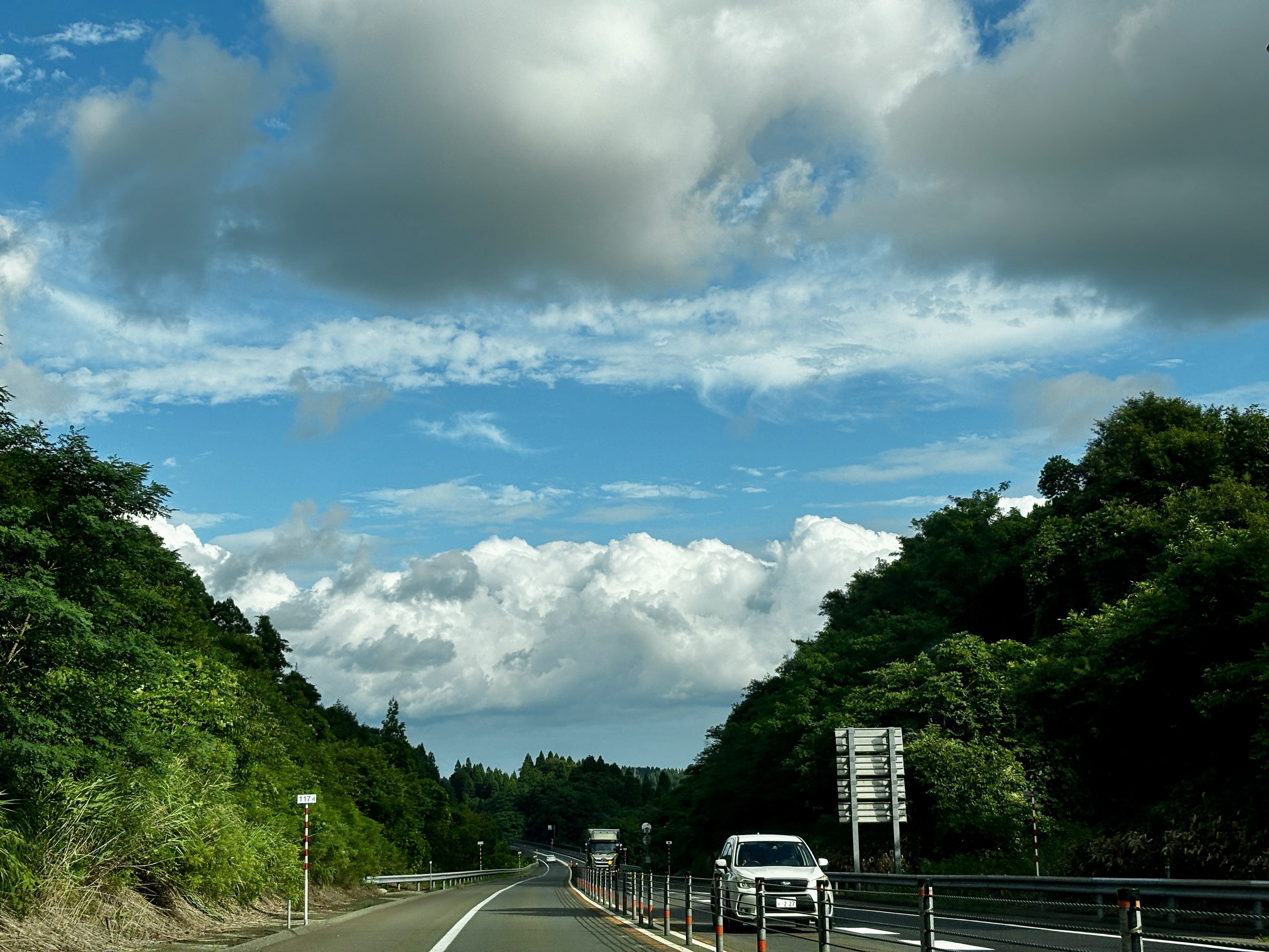
Akita Expressway cuts east to west through the mountains (photo by author).

Rice is the staple in Japan. But it is also more than just food, as the anthropologist Emiko Tierney Ohnuki explains in her book, Rice as Self: “As a metaphor of self, rice paddies are our ancestral land, our village, our region, and ultimately, our land, Japan. They also represent our pristine past before modernity and foreign influences contaminated it” (p. 10). Later she explains, “The notion that each rice grain has a soul and that rice is alive in the hull are fundamental to the meanings assigned to rice in Japanese culture…” (p. 55). The rice paddies prevail even as the countryside empties of people and the farming population ages. This phenomenon also explains the widespread resistance to foreign rice by Japanese consumers, even as rice prices have soared this year and been a major contributor to rising inflation.

Tohoku, with its relatively cold climate, has experienced several rice famines in the recorded history, many of them linked to natural disasters, such as cooling climate after volcanic eruptions. Latest in 1934, the rice crop in Iwate failed due to cold weather, causing many poor farm families to send their children to Tokyo and beyond as laborers, or to work in the water trade, or to join the military, all of which contributed to the pre-war unrest. In better times, Tohoku rice is arguably the best in the world, thanks to the clean environment and water.

Japan’s environmental history is at best checkered. The case of mercury poisoning in Minamata on the southwestern island of Kyushu starting in the late 1950s is perhaps the most famous incident of industrial pollution with dramatic consequences to people’s health. But there were plenty of others where the environment and human health were sacrificed to the altar of progress in post-war Japan, such as the Itai-Itai disease caused by cadmium poisoning discovered in 1967 or the PCB poisoning in and around Kitakyushu the year after. Opposition to industrial pollution was silenced, communities divided, and victims shunned, as the country focused on rebuilding and getting rich at any cost.

Since those years, much has been done to improve the environment. Environmental consciousness is high: practically no one litters, recycling is religiously practiced, and the cities are clean. Air and water pollution are now controlled. The largest urban conglomerations – Tokyo, Yokohama, Osaka, Kobe, Kyoto – are concentrated in the Central and Western Kanto and Kansai areas.

The Japanese culture has been largely based on the desire to control nature. This has its traditional expression in Japanese gardens in which nature has been forced into beautiful, but artificial depictions of, well, idealized nature. The tortured, but gorgeous bonsai trees are another example. For many Japanese, nature is at its most beautiful when it is well regimented.

Another factor playing into the tendency to control nature is the prevalence of natural hazards. Japan consists of a chain of volcanic islands in the middle of the largest ocean of the world, the Pacific. The country is prone to earthquakes that happen daily (although larger ones are of course rarer). Despite its name, the ocean frequently acts in ways anything but pacific, sending typhoons and tsunamis to the coasts. The eruption of the iconic volcano, Mt. Fuji, is long overdue. If a natural hazard exists, Japan is bound to have it in quantities. Consequently, Japan is also the best prepared nation towards natural hazards: even massive earthquakes tend to have relatively few victims.

There are exceptions, the most prominent one in recent history being the earthquake that hit Tohoku on the Pacific side on March 11, 2011. The 9.1 magnitude earthquake and the ensuing tsunami flattened out much of the Sanriku coastal zone in Miyagi and Iwate prefectures and killed almost 20,000 people. The tsunami also caused the meltdown of the Fukushima nuclear power plant resulting in the worst nuclear accident in human history, barring the Chernobyl accident in current-day Ukraine in 1986.

Up in in the mountains between Iwate and Akita, nature is largely unspoiled thanks to a low density of human population, little urbanization and even less industry. That in itself is largely the result of the mountainous topography, the harsh winters, and the relatively short growing season. Yet, virtually all flat valleys are under cultivation.

The topography is also what has saved Japan’s forests. This is one of the most forested countries in the world outside of the tropics, with 67% of land area covered in forests. Japan in the post-World War II years extensively replanted forests, with species like sugi and the Japanese cypress. According to environmental historian Catherine Knight, about 40% of Japan’s forests are currently man-made plantations, not naturally occurring ecosystems.

The forests would most certainly have been decimated had it been easier and more economical to exploit them. Instead, it is said that Japan has outsourced deforestation, especially to Southeast Asia where its companies have long maintained logging operations thereby saving the forests on the home islands.

What is evident even up here in Tohoku is the careful management of natural hazards and nature itself. Mountainsides where roads cross them are protected by engineering works to prevent landslides, which can be caused by earthquakes or just erosion of the slopes.

Japan has been referred to as the “construction state.” The Ministry of Construction and the numerous big and small companies operating in the sector wield significant power. They provide substantial employment and spend remarkable amounts of money as they fix the real and sometimes self-created problems.

In the decades following World War II, most rivers in Japan, notably near urban centers on the Kanto Plain, were straightened and channelized in concrete to control natural flow and meandering. Contrary to expectations, however, these works meant for flood control often had the opposite effect, while also harming ecosystems along the rivers. The government, to a degree, recognized the mistakes and mended its ways, leading the River Bureau of the Ministry of Land, Infrastructure, Transport and Tourism to reverse engineer riverine habitats since the 1990s. Today, Tohoku’s largest river – and to me the dearest – Kitakami-gawa flows quite freely from its origins at Mt. Nanashigure to the Pacific Ocean.

But the time of the construction follies is not over. Following the March 2011 earthquake and tsunami, which destroyed virtually all small fishing ports on the Sanriku coast, many survivors left. Especially younger people moved to Sendai and other cities. Few of the refugees had any intention to return to the coast. Given this and the fact that the tsunami threat will not disappear, to me the sensible thing would have been to develop the coastline to an area for nature and recreation. Instead, the government has invested tremendous amounts of resources to massive earth moving and construction works to raise the coastline, in the process destroying much of the nature literally flattening hills. This for a handful of mostly old people who may return. That just demonstrates the natural tendency of the authorities and the construction industry to find an engineering solution to any problem.

Driving through the central mountains, however, these problems are far away. Yet, just like Sanriku coast, the countryside in the remote sparsely populated areas is further emptying. Most of the young people have moved to cities and the small farmers have few heirs to take over their plots (although there is a small back-to-the-land movement driving some younger urbanites to a more organic lifestyle in the rural areas). One might think that depopulation might lead to rewilding of the land – a popular concept in some parts of Europe – and there may be some benefits to the wildlife. However, the traditional farming system – satoyama – is surprisingly well adapted to the natural ecosystem. The rice paddies themself are ecotopes of their own, with a vibrant fauna and flora. There are studies that suggest that losing this agricultural landscape is a threat to the biodiversity that has evolved in them.

Japan is making measurable progress on climate and environmental fronts and is rolling out a nature-positive economy strategy, which includes the “30 by 30” conservation target, aiming to protect 30% of land and marine regions by 2030. Yet, challenges remain, not least as global temperatures rise affecting climate and weather in this island nation.

Tohoku’s rugged landscapes remind us that Japan’s story is not just one of futuristic glory and control of the environment, but of coexistence with nature, which offers lessons in resilience and balance that Japan, and the world, will need more than ever.


Saturday, September 28, 2019

Qingchengshan beauty in the mist


[This trip took place in September 2018 after the Asian Evaluation Week that was held in Chengdu, Sichuan.]


It was a grey morning with a constant drizzle in Chengdu when my friend Nanthi and I decided to stick to our plan to head towards Mt. Qingcheng, a sacred mountain where it is said Taoism was born. We grabbed a taxi and headed to the Chengdu North railway station where we arrived less than half an hour later. We had consulted the train schedule and left ourselves ample time to catch the targeted train. This was good, as we would need ample time to figure out how the system worked.
The rainy square in front of the station was crowded with people. There were many who looked like migrant workers from the countryside. A tiny elderly couple – or perhaps they were just middle-aged whose life had taken a toll on them – were walking with huge backpacks on their backs. Some seemed to have camped by the station keeping the rain out with plastic sheets. A tall, slim woman in an elegant red dress and matching high-heel shoes was leading a couple of older peasant-looking folks along – relatives from the countryside, perhaps even her parents (what a difference a generation and life in the big city makes!).
Initially, we headed towards the station gate and pronounced “Qingchengshan” (‘shan’ being the Chinese word for mountain) to the young lady occupying the booth that we first approached. Her face didn’t register any understanding of the message, but soon a uniformed guard appeared from the side and pointed us toward another large building across the vast square. Nanthi, being his stubborn self didn’t want to follow the instructions – after all, he argued rather logically, we were at the gates to the railway station from where the train would likely leave – but I convinced him to go look at the other place. We crossed the square and first arrived at a fence with a sign “Emergent Exit” (apparently it wasn’t quite ready yet) but to the right of it, there were stairs that led to a place clearly identifiable as ticket counters. So we placed ourselves in two lines to see which one would move faster. I had used my smart phone translation to pull up “Qingchengshan” (青城山) in Chinese on the screen. Soon enough we had our tickets in hand. The one-way trip put us back by ¥19 or about $2.75.


We returned to the station gate where we had started and presented the tickets. Once the nice lady had inspected our passports, we were allowed into the spacious waiting room of the station. There were perhaps a dozen or two other people there, but the large room appeared almost empty. Now that we had made it in, we actually had some time to look around in the few shops around there. There were a couple of grocers that sold whatever you might need on a train trip, from snacks and beer to small souvenirs. Food-wise, the choice was between McDonald’s and a local place that specialized in deep fried chicken feet. Luckily we had had a good breakfast.

 Our train left on time and we had numbered seats, so boarding was orderly even though the train became rather full (apparently, other passengers had been able to time their arrival to the station better). It was a bullet train that reminded me of the shinkansen in Japan: new, clean, sleek and fast. Like in Japan, the train attendants would stop and bow as they entered the compartment. Leaving from the northern part of the city, the tracks first traversed residential areas where everywhere there was major urban renewal taking place. Chengdu has grown to a metropolis of 14 million people. All over, old shabby looking buildings were being torn down to be replaced by massive modern apartment blocks.

As there were a few stops on the outskirts of the city, the bullet train didn’t travel at top speed but it still reached 190 km/h at some stretches. While the American flagship train, Acela, could in theory reach the speed of 240 km/h, it never travels that fast on its route from Washington, DC to New York and Boston due to the poor condition of the old tracks. On that stretch, there are a few patches where the train can go up to 160 km/h, but also passages where the top speed is just 40 km/h. I am convinced that this lack of upgrading and maintenance of infrastructure will be the downfall of the USA. But there are too many politicians, especially in the Republican party, who consider trains and other forms of public transport to be socialism and therefore not to be funded.


In about 40 minutes we reached the Qingchengshan station about 60 km northwest of Chengdu. The station was modern and clean. In front of it there was again a wide square on the other side of which we spotted a tourist information booth. Again, our initial approach caused some consternation but the person at the booth managed to fetch a young woman with adequate English to cater to us. We ended up taking a taxi to the entrance of where the Mt. Qingcheng cultural protected area starts. Beyond that, no motorized vehicles were allowed but there were electric vehicles, not unlike large golf carts, that shuttled people from the parking lot to the traditional gate of the area. We invested in a ticket to save some time instead of walking and were soon speeding soundlessly through a road lined with beautiful forest.


Once we reached the gate to the mountain, we disembarked. From here on, we would walk. The entrance to Mt. Qingcheng is a sight in its own right: a striking structure with pagoda-like tiled gables, guarded by imperial guardian lions carved from stone on both sides. The area outside of the entrance itself was surrounded by beautiful evergreen forests. All the buildings were traditional in style. But passing through the gate we entered another world of lush green vegetation and surprising peacefulness despite the many people around us. The air was pleasantly cool but very moist. A stream forming small waterfalls ran from higher up in the mountains. Mt. Qincheng is located at the southwest part of the traditional Dujiangyan irrigation system.


We followed the path that was covered with meticulously maintained wooden planks. We first arrived at the Natural Pavilion, which according to the sign integrates, “to a great extent,” the Taoist ideas of “syncretism between heaven and man, leaning from the nature, and the three begetting all things of the world.” The sign also informed us of the more than a hundred kiosks and pavilions on Mt. Qingcheng, which are exquisitely decorated and feature “quietness, depth, queerness, peril, grandness, beauty, aliveness, profoundness, etc.” Our expectations were raised.


Continuing our way up the hitherto mercifully gentle slope we arrived at a lake at a higher plateau. The scenery was breathtakingly beautiful with green mountains shrouded by low-hanging clouds on the other side of the still lake. A decorated ferry crossed the lake ferrying travelers across. We saw no other foreigners anywhere. Soon we, too, were on the ferry that quickly became crowded. The crossing took only a few minutes and we disembarked on the other side.


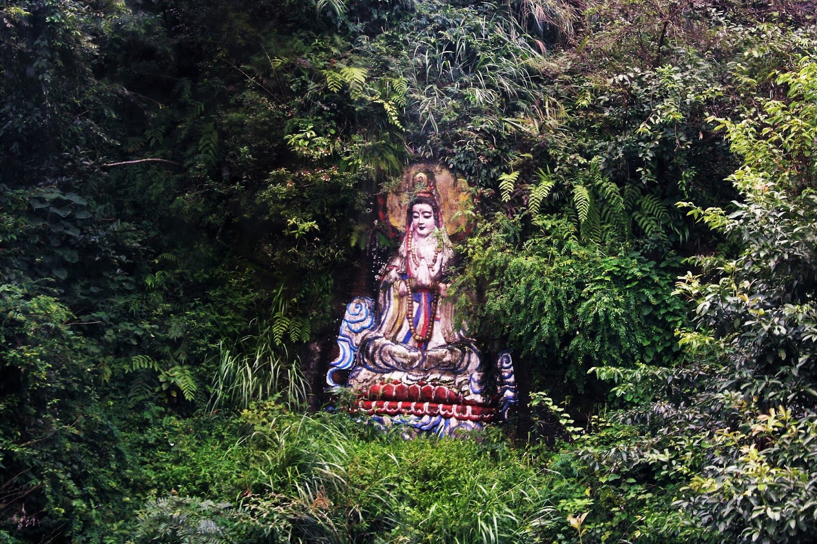
Here was a cable car station and we boarded a gondola that took us up to a high peak. From the gently swaying gondola we could see that the mountainside was covered in thick, almost inpenetrable green vegetation, but there were Buddhist objects hidden in the shrubbery. Having placed them where they were must have taken plenty of determination and effort.


We first arrived at the Ciyun Tower, a wonderfully beautiful structure but with no apparent religious meaning.

We continued on foot across the mountain forest with moss-covered rocks on both sides until we reached a further peak. Mt. Qingcheng is 1,260 meters tall and we must have been close to the highest point. From here the view was exactly like in a classic Chinese ink wash painting from Tang Dynasty (618-907). The view was across a valley with several other peaks standing at various distances giving the impression of depth continuing in eternity. The fog made the landscape look monochromatic.


Continuing our climb, we arrived at the Shangqing Palace. The palace was originally built during the Jin Dynasty (265-420) but was subsequently destroyed and rebuilt during the Qing Dynasty (1644-1912).  The place was decorated with red flags of Buddhism and equally red candles burned in the incense burners. An old monk and a young temple maiden with a long braid down her back were guarding the site. What a blessed life they must lead, I thought.

In the area there are many of Taoism’s most revered buildings amongst the gorgeous natural landscape, each more beautiful than you could imagine.


We continued our hike towards the summit of Mt. Qingcheng from where the views were magnificent. Unfortunately, because of our limited time it was impossible to see even half of this unique place and its incredible cultural history. We had to descend again so that we would be able to catch another train and get to Chengdu by evening. Along the way, we encountered numerous gorgeous buildings, some of which contained shops where one could purchase refreshments and Buddhist items, such as prayer beads.


We retraced our steps, took the cable car down and crossed the lake to the opposite direction. In the process we had walked for several kilometers and given the gradient, I could feel it in my leg muscles. Luckily, though, I did not have to submit to be carried down in a bed suspended between two long bamboo poles. This mode of transportation was readily available. The men in charge cheerfully ran along the mountain paths with their load resting in the crib. Their lungs and circulation must have an incredible capacity to absorb oxygen.


Further down we came across kiosks that sold a large variety of dried mushrooms and other products from the mountain. No doubt they would all have medicinal qualities – perhaps some bore the secret to the porters’ extraordinary stamina.


We returned passing by the Enchanting Pavilion and the Happiness Pavilion until we were back at the Nature’s Pavilion heading towards the Celestial Hall until we reached the clear stream and the gate to Qingchengshan at the elevation of 780 meters above sea level. Here a sign explained that, according to monitoring results, the negative oxygen ion concentration here was 180 times that of the city. This was the result of the particular geological conditions, the dense forest vegetation and the humid climate of Mr. Qingcheng. The sign further explained that when the negative oxygen ion concentration reaches a certain degree, “it will make people breath smoothly and feel refreshed, thus is good for immunity system and health.” Based on my experience today, I have no reason to doubt these beneficial effects on the health of both my body and mind.

Friday, September 27, 2019

Excursion to the Western Mountains


[In September 2019 I attended the annual Asian Evaluation Week in Kunming, Yunnan. In the late-1990s when I was with the United Nations University based in Tokyo, I had a joint project in Yunnan with the Kunming Institute of Botany, which allowed me to visit Kunming and travel around the beautiful province of Yunnan on several occasions. This was my first time back in 21 years. Just earlier this week, I visited my then collaborators with whom I have kept in touch through all these years, Guo Huijun and Liang Luohui. Guo who was a young promising researcher when we worked together has last year been appointed President of the Southwestern Forestry University, a major research university with 22,000 students. Liang, now affiliated with the Chinese Academy of Sciences was the one who introduced me to Yuanmei Jiao.]

Huating Temple
It was a foggy morning and there was a palpable threat of rain in the air when Zhijuan picked us up from the hotel in southwest of Kunming. Miki and I were ready for a short excursion to the hills just 12 km outside of town. Zhijuan Zeng was a graduate student of geography at Yunnan Normal University. Her professor, Yuanmei Jiao, had assigned her to accompany the foreign visitors on this trip. Dismissing our praise for her hospitality and kindness, Yuanmei assured us that the day trip would be good for Zhijuan’s English practice. (Zhijuan’s presence would definitely make the trip easier. A year ago, having attended the same annual meeting in Chengdu, my friend Nanthi and I took another mountain and temple tour by ourselves. We managed well, despite the language barrier.)

Zhijuan, Miki and I took a taxi to the foot of Xi Shan (西山) or Western Mountains. Driving through the town, gave a clear indication of how the city has grown both vertically and horizontally in the intervening two decades I have been away. Thankfully, it still has retained much of its charm, thanks largely to the genuinely welcoming people.

When we reached the base of the mountain, we switched to a bus that would take us further up. The Xi Shan is a protected area and a popular recreation spot for locals because of the clean air and beautiful scenery. My friend Liang, a Yunnan native, says that he comes here at least once a month when he needs some rest for his soul. We first got off the bus at a temple halfway up. Huating is a Buddhist temple with a history that reaches back to the Yuan Dynasty (1271-1368). The temple itself was first established in 1320 but it got its name – Huating – only in 1441 by Emperor Yingzong of the Ming Dynasty (1368-1644). The temple, having been built of wood, suffered several calamities during its history but was always reconstructed. This is a common practice with temples in East Asia and the fact that something has been destroyed and rebuilt many times over the centuries does nothing to reduce its historical value. The current Huating Temple stems from the 1920s. Huating is a National Key Buddhist Temple according to the Chinese government.

The temple consists of two main halls, the Four Heavenly Kings Hall and the Mahavira Hall. When you enter the Four Heavenly Kings Hall, you walk in between large statues of Heng and Ha, two ancient Shang Dynasty generals in Chinese legend, before reaching the statues of Buddha and the bodhisattva Skanda (guardian of Buddhist monasteries) at the center.


Zhijuan explores Huating grounds
Although not particularly large, the Huating is very beautiful and has a peaceful atmosphere. Temple gardens are often important repositories of local biodiversity, as the groves have been spared from cutting down for long periods. There were a few other visitors, all Chinese. Two of the women stopped to pray at the Buddha.


Having spent a good hour admiring the Huating and soaking in its peacefulness, we returned to the roadside to wait for another bus to take us further up the hill. We were lucky as the rain never came. In fact, from time to time the sun would peek out from between the clouds.

We got off at the final stop of where the entrance to the mountain peak was located. Here there were considerably more people but, again, no other foreigners in sight. Soon after the gates, the path started to climb. The famous Longmen Grottoes have been carved into the hillside during a 72-year period starting in 1782 during Qing Dynasty. The grottoes are connected by narrow stone-paved paths and extremely steep steps. I soon started to feel the exercise in my lungs. We were between 2,250 and 2,300 meters above sea level and the thin air together with the strain of the climb were getting to me. Even Miki confessed that he was feeling tired. Although I had been in Kunming for a week and the city itself lies at 1,800 meters’ altitude, I hadn’t gotten accustomed to the elevation. This being a weekday, there were lots of old people on the path. I admired their stamina.


Taking the excuse of studying some historical construct or admiring the view, I rested at every level place during the climb. The 23-year-old Zhijuan didn’t seem to grasp that we were getting rather exhausted but she accepted the frequent stops. Having said that, the views from the hill down to Dianchi Lake and beyond to the city were quite stunning. The air was still rather misty, which limited the visibility. Still, in the balance, I was pleased that the sun wasn’t blaring upon us from a cloudless sky.

The hillsides were extremely steep and at times the path passed through grottoes so low that I had to crouch to get through. The workers who constructed the trail 250 years ago clearly were smaller than I. 
Dianchi Lake with Kunming City in the distance


We eventually reached the destination: the Dragon Gate complex resting on a hillside so steep that the drop is absolutely vertical to the lake shore. Having spent some time admiring the place and taking photographs of each other with the view, just like all the local tourists, it was time to head back. The way down was easier on the lungs, but walking down the narrow stone steps that were moist as a result of the earlier fog, was hard on the legs as one had to tense the thigh muscles constantly in order not to roll down the hill.

The excursion was short but refreshing. Back in the city, we still had daylight to enjoy a leisurely walk around the beautiful Cuihu park with its lakes and waterways covered with lotus waterlilies. Unfortunately, the flowering season was over and only a few of the plants still bore gorgeous flowers. I personally was most happy to be walking on flat land.